 Image by SoA
Project
Pyungchang Art Culture Complex
Client
Seoul Metropolitan Government
Location
Seoul
Year
2017
Status
Competition
Program
Library, Museum, Archive
Size
5,169 sqm
Partner in charge
Yerin Kang, Chihoon Lee, Jaeweon Lee
Design team
Jaehwee Lim, Hakyeong Jeon, Minseong Kim, Hyewon Kang, Minjun Kwak, Hwanjun Choi
Landscape
Youngjoon Choi (D+H)
프로젝트 명
평창미술문화복합공간
클라이언트
서울시
위치
서울
연도
2017
상태
현상설계 기본설계
프로그램
도서관, 미술관, 아카이브
규모
5,169 m²
책임파트너
강예린, 이치훈, 이재원
설계팀
임재휘, 서승희, 전하경, 곽민준, 최환준
조경설계
최영준(D+H)
Build ‘Geographical Space’
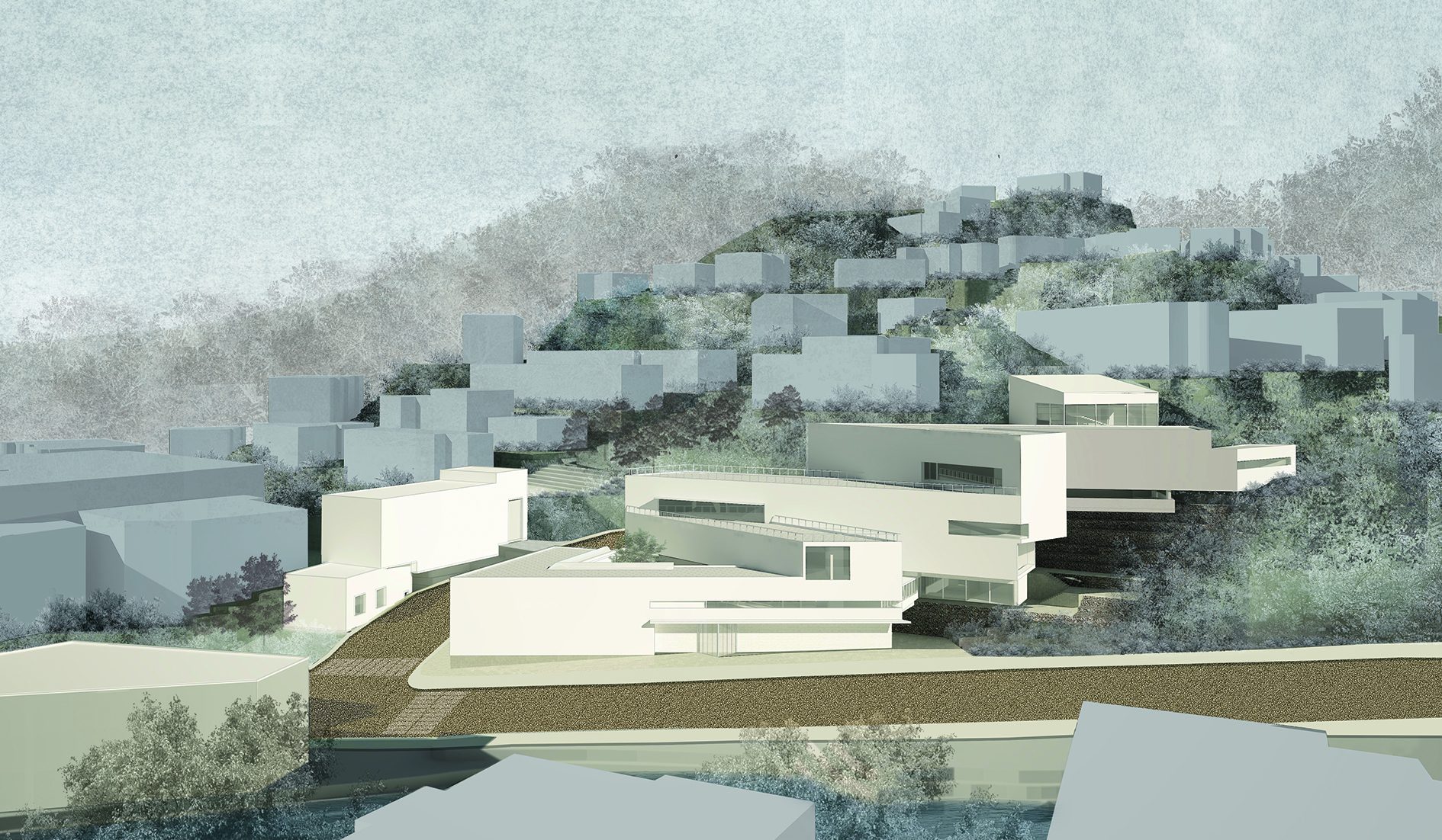
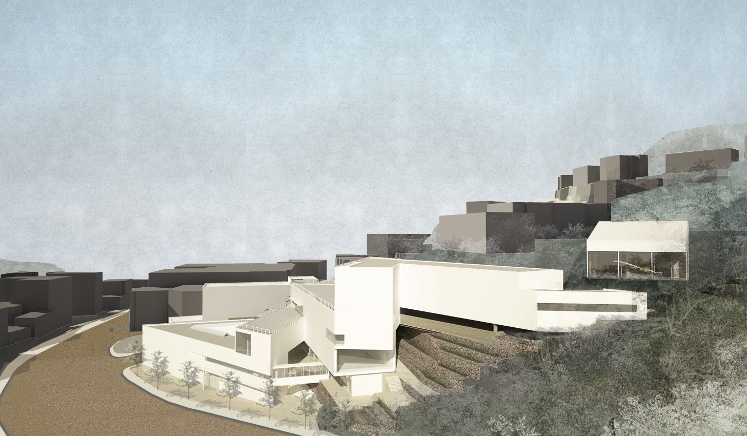
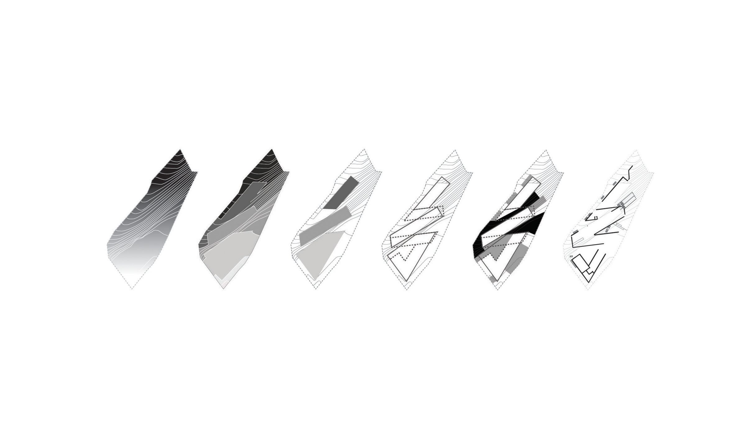
Condition of the site which is located foot of Bukhan mountain provide a motive of ‘Geographical Space’ that architecture and land can make a harmony. ‘Geographical Space’ is an architectural scenery created when contrast relation between nature and artificial is overcame and coadapted. Justify between space of artificial and nature by responding to the intimate structure of land. It’s a process that spatialize of the topography which was existed as non-spatial or territory through architecture plan. By this, nature and architecture can be a united spatial structure. The process to be a ‘Geographical Space’ follows as below.
- Site Design as understructure.
- Plan of Architecture, Topography and Between space
- Build coadapted ‘Geographical Space’
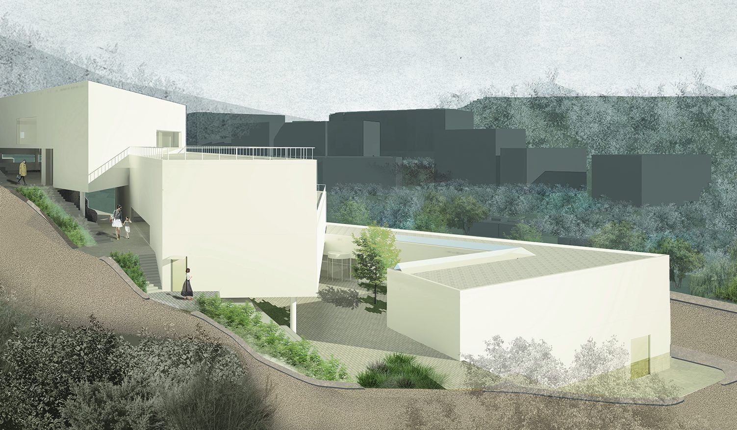
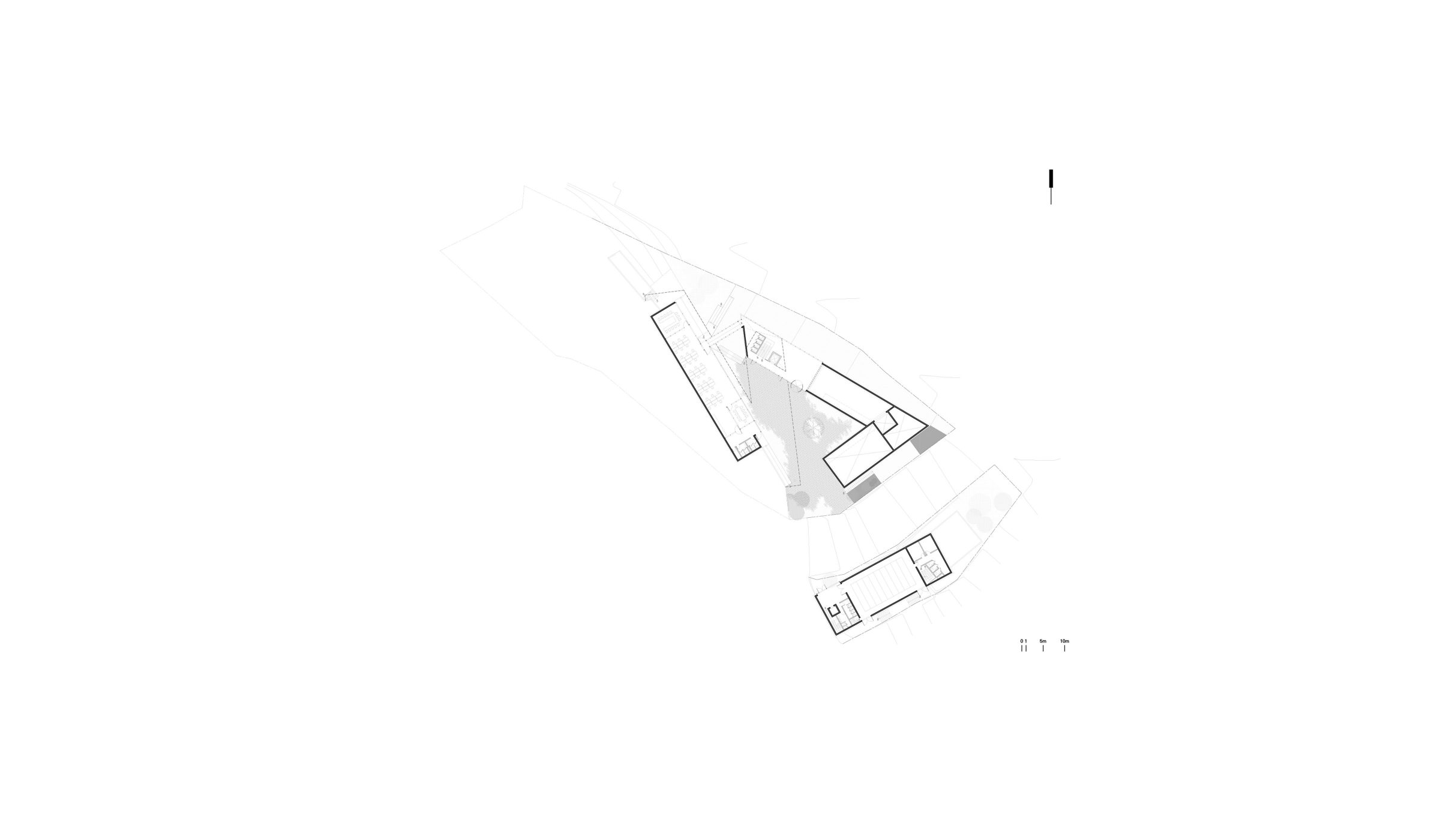
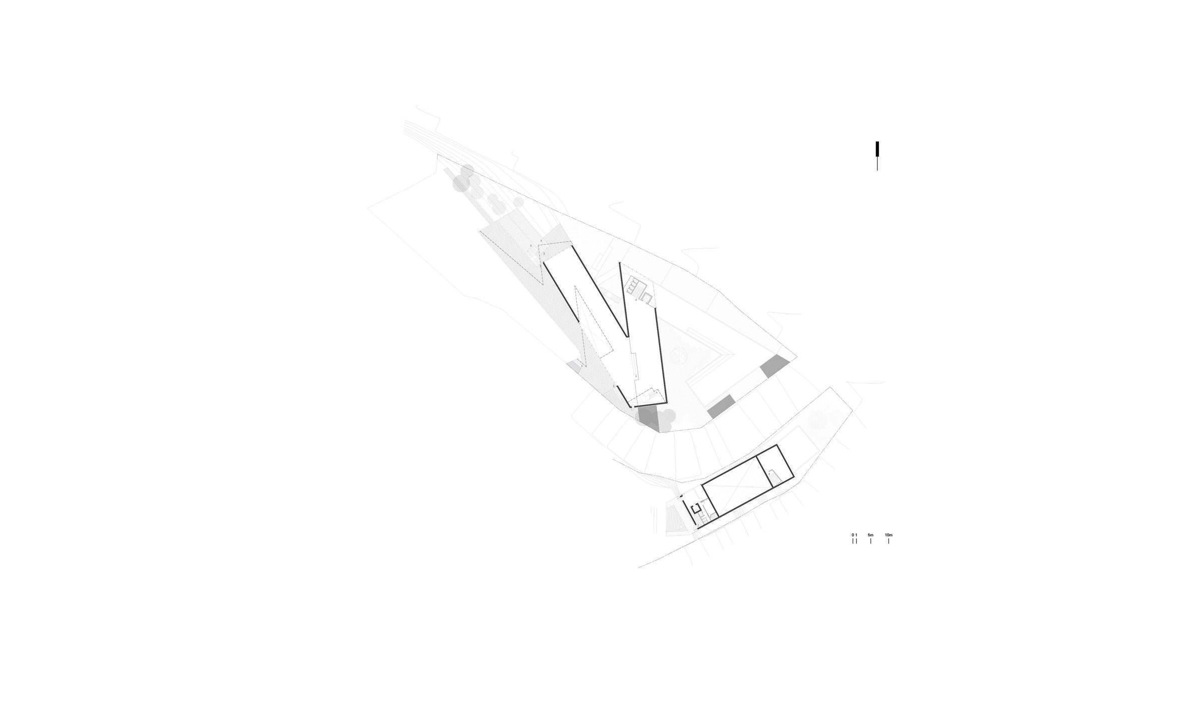
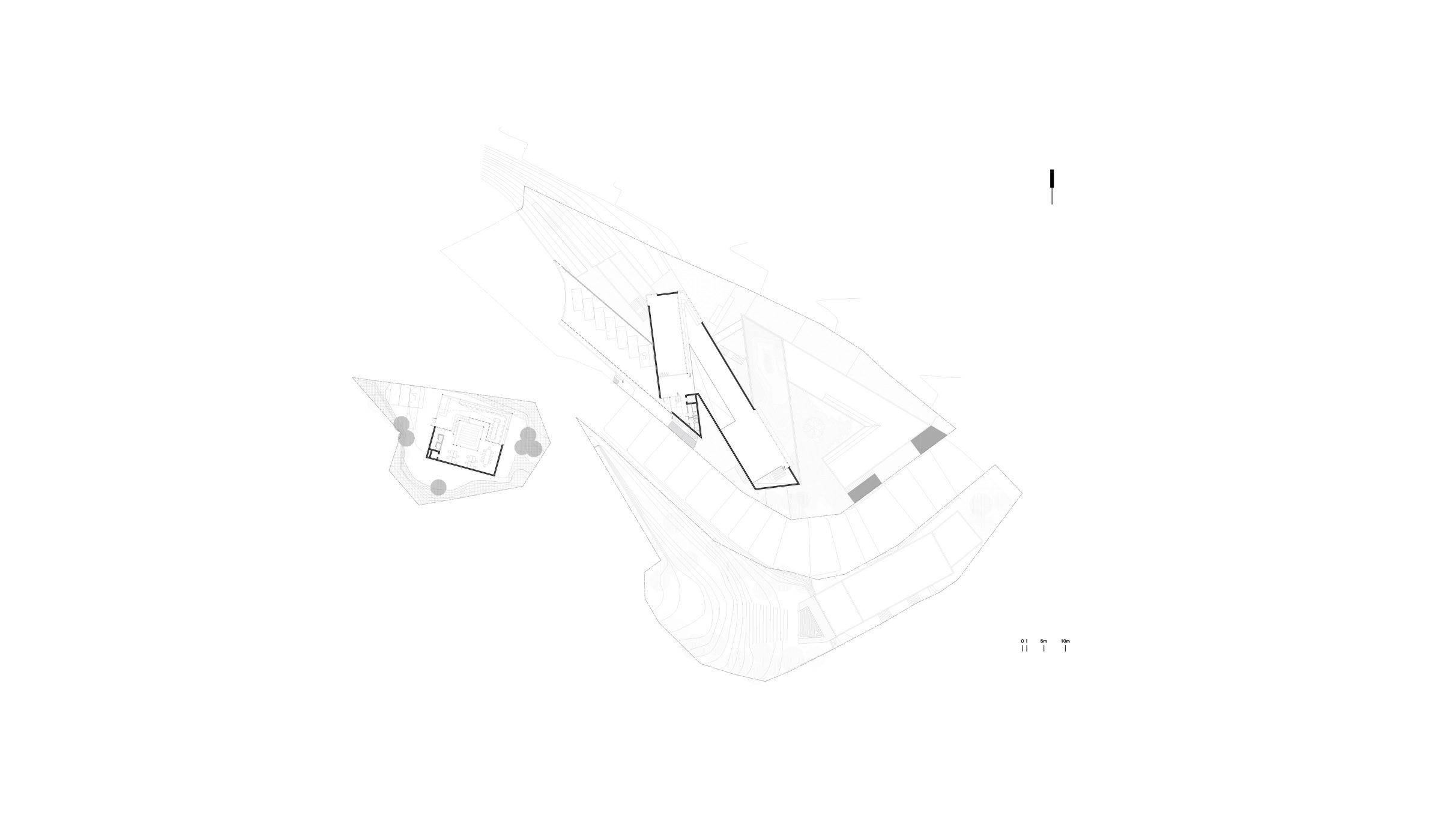
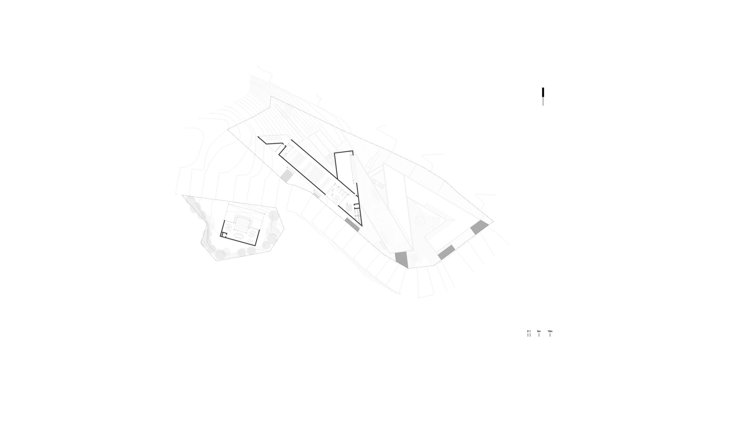
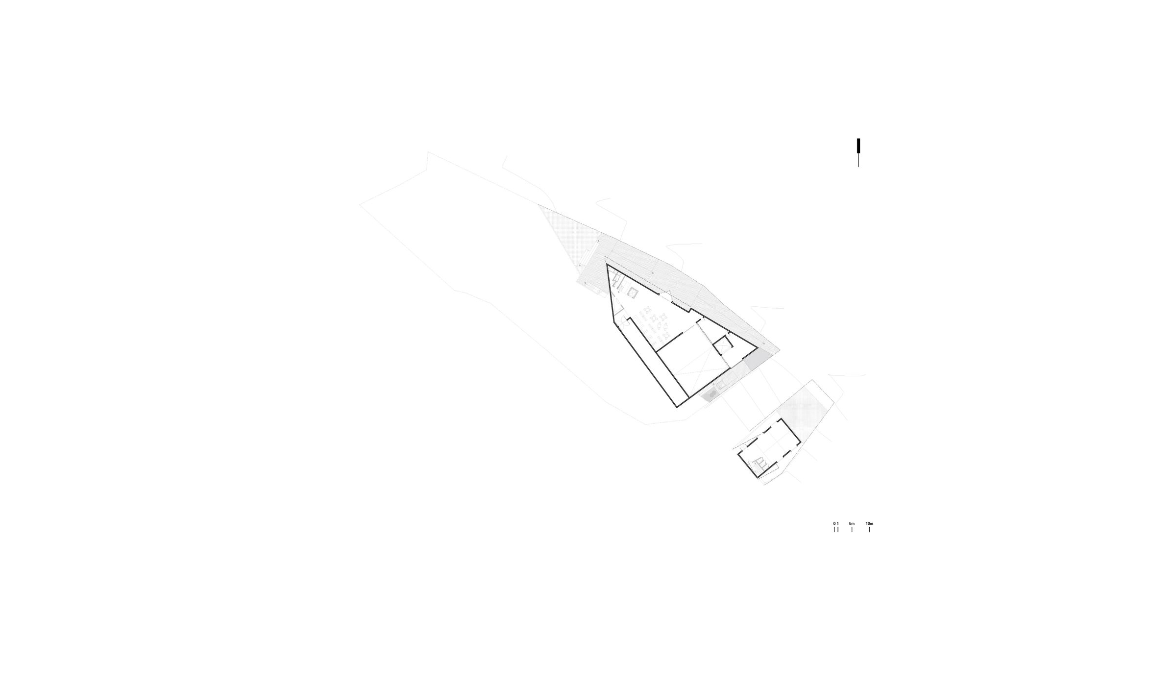
Start of this plan is select an area that can put building on it with minimal transformation of original foundation. Put volume of architecture building on 1st minimal transformed topography. Architecture and topo is controlled to make various relationships between inside and outside as they are adhered, gapped or floated. Based on this, nature that existed as non-spatial evolve to topography which is extension of architecture or architectural space as itself.
Program layout as a ‘Continuous Progress’
Analyze provided program as circulation system not as a separated space. ‘Production - consumption of Cultural art’, ‘creator – audience’ and ‘process – result’ are coexisted and interpret each other as a multi continuous structure. So, focus on design for continuous progress not for layout of each separated rooms.
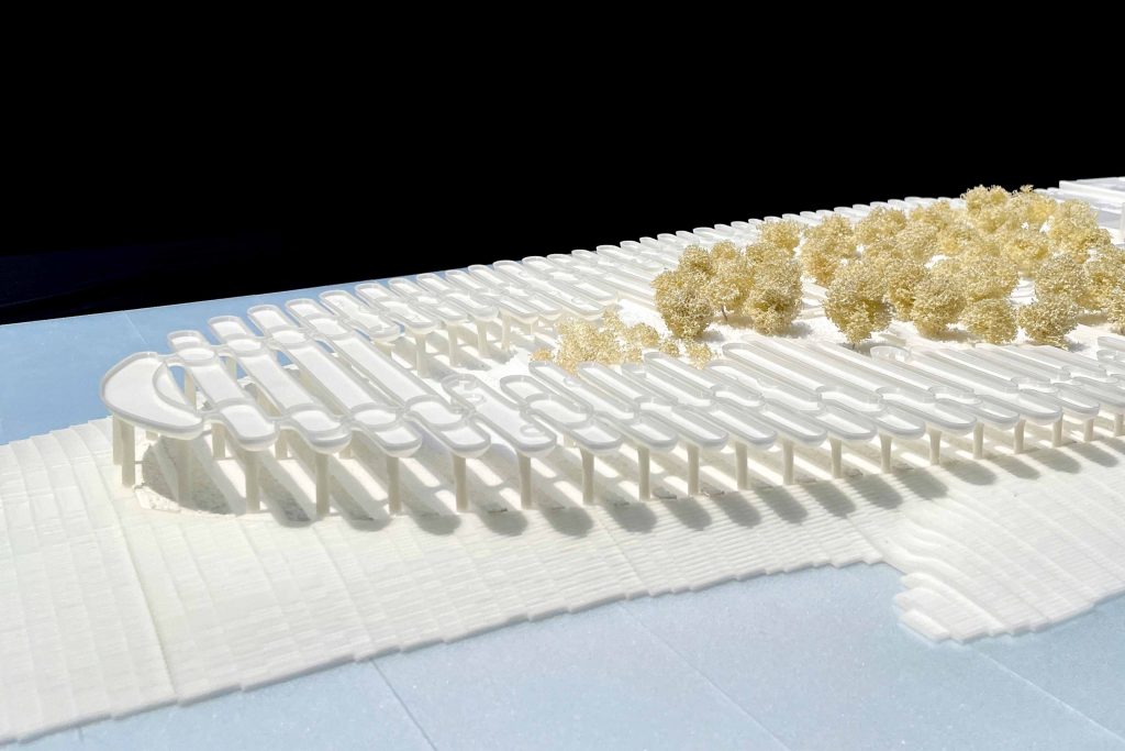
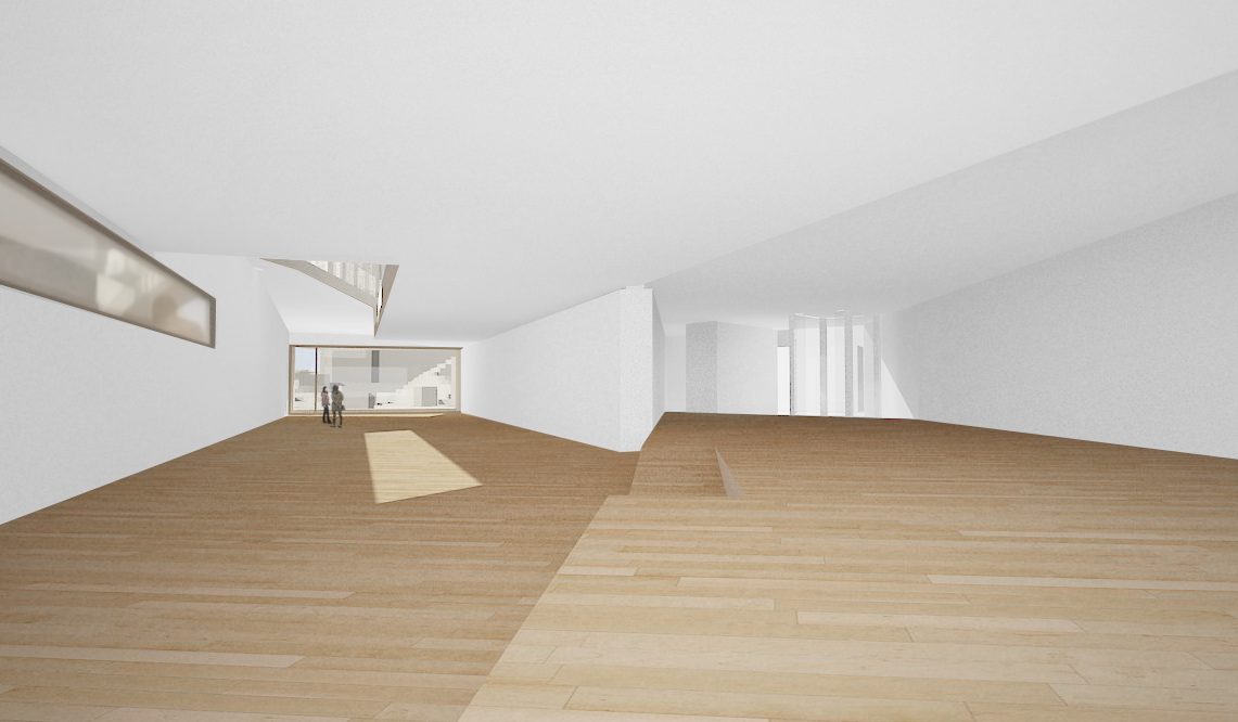
By Deciding area of space for main programs setting a long horizontal room as a unit and connect these spaces, continuity of ‘Exhibition - Open archive platform - Community Learning space – Archive – Research Lab’ can be created and suggested as a spatial structure supporting cultural production and circulation of reproduction based on Art.
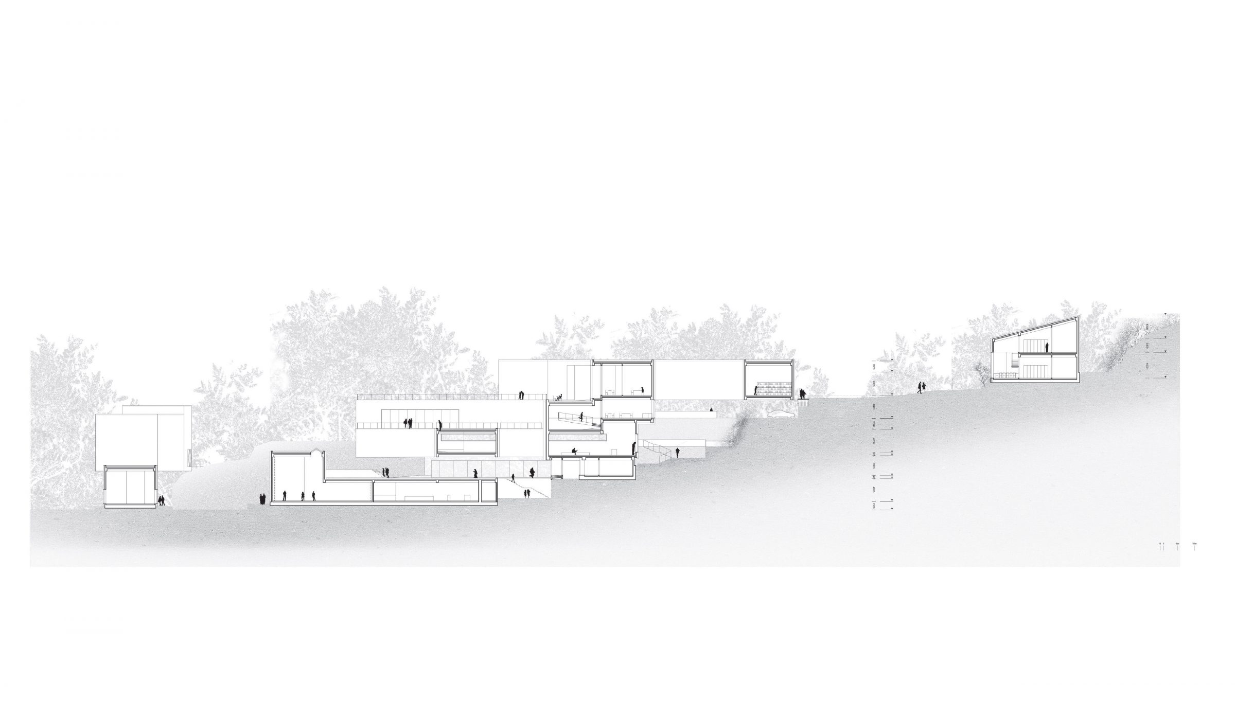
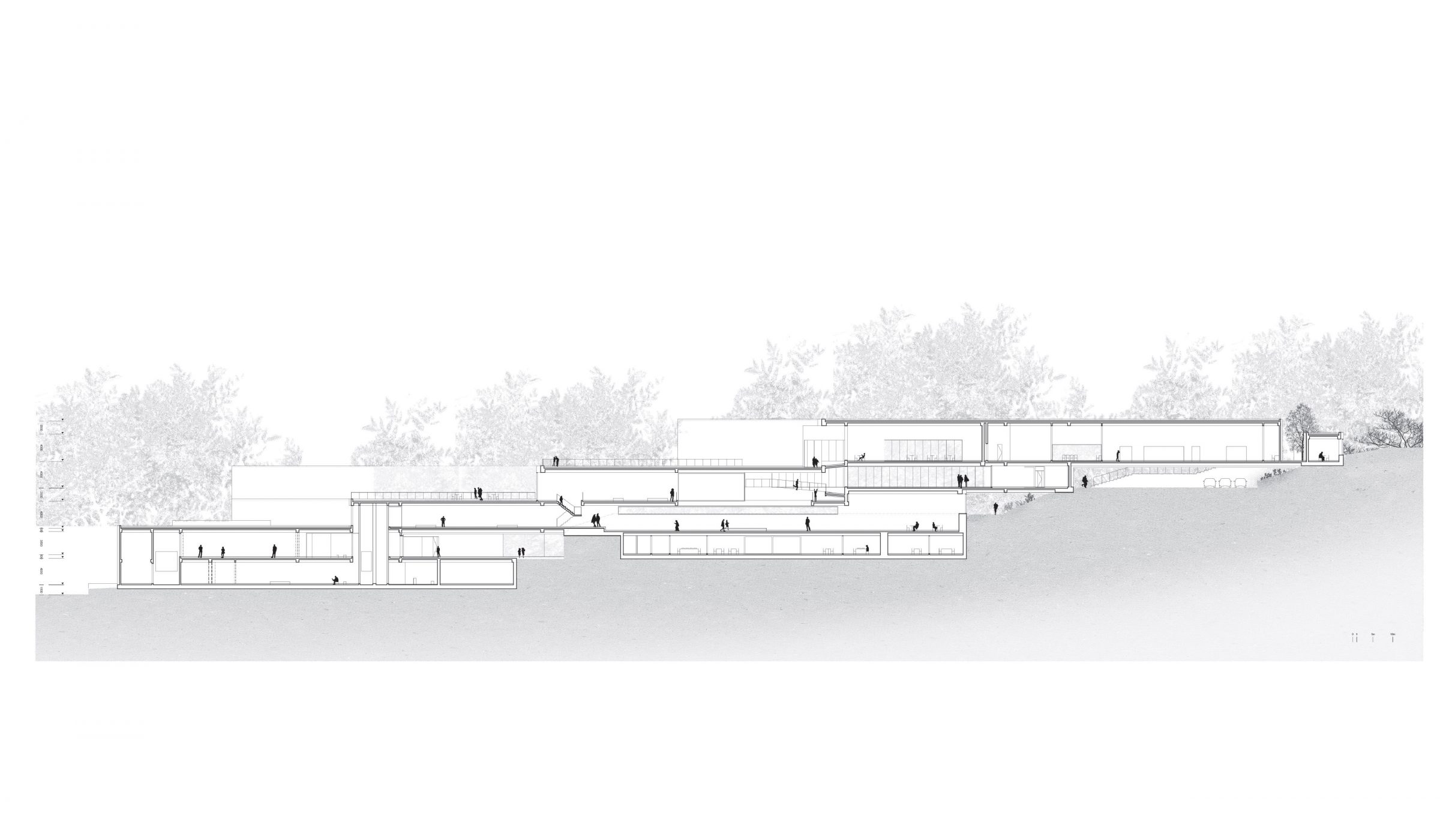
Main Starting point of this building is located on +5.5m. Raise visitors up to the entrance of “pyeongchang 20 gil (street name)” and induce their access to inside of building. Array programs that can be connected continuously to main entrance. Based on the level of Lobby, put special exhibition space under. Make separated accessible route to here from ‘Pyeongchang munhwa ro’.
On the upper area of Lobby, locate programs that is predicted to be mostly used by visitors such as Open archive platform, Community learning center and so on. By locate Book Lounge and Storage facility on the highest area of the site, enhance possibility of connection to Research Lap of C site.
Plate of in and outside function as platform
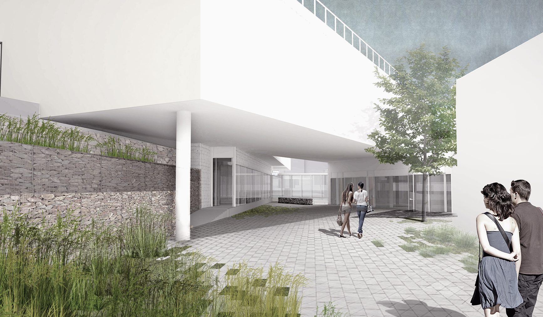
Each of the all programs are longish plate. These plates are connected and make outside between space. Each outside space function an outside platform by induce access or justify boundary of natural space. Especially, induce natural access to each program from roads is the most important role of it by overcoming 20m of height difference also, as making landscape using topography just itself, minimize damage of land. In short, as inside justify outside and outside function for inside again, whole site can be circulated in one system.
Four sites connected by topographic space.
Four sites are connected by pyeongchang 20 gil. Find a connection between sites using the meeting point of road and topographic area. Each site planed by space system connecting “Road – outside plate – inside” and make natural connection between bridge, underground pedestrian and so on. Especially, in the case A and B site, by locate main entrance and outside area on different side of street and facing each other, make it feels as one area.
‘지형적 공간’의 구축
북한산 자락인 대지의 조건은, 자연스럽게 건축과 땅이 어우러진 '지형적 공간’의 모티브를 제공한다. ‘지형적 공간’은 자연과 인공의 대립관계를 극복하고 상호 진화함으로써 생성되는 건축적인 풍경이다. 땅이 가진 본질적인 구조에 구체적으로 대응하면서 인공과 자연의 사이 공간을 정의한다. 건축 계획을 통해 비-공간 혹은 영역으로 존재하던 지형을 공간화 하는 작업이다. 이를 통해 자연과 건축이 하나의 통합된 공간 구조로 완성되도록 한다. '지형적 건축’이 되기 위한 계획과정은 아래와 같은 흐름으로 진행된다.
- 하부 구조로서 대지디자인
- 건축과 지형, 사이 공간의 계획
- 상호 확장된 '지형적 공간'의 구축
계획의 출발점은 원지반의 변형을 최소화 하며 건축이 앉혀질 수 있는 영역을 선정하는 것이다. 최소한으로 1차 가공된 지형에 건축의 볼륨을 얹는다. 건축과 지형은 밀착되거나 벌어지거나 띄워지는 등 다양한 내외부의 관계가 만들어지도록 조율된다. 이를 통해 비-공간으로 존재하던 자연은 건축이 연장된 지형으로 진화하거나, 지형 그 자체가 건축적 공간으로 확장되도록 한다.
‘연속된 과정’으로서의 프로그램 배치
주어진 프로그램을 개별 공간이 아닌 순환하는 체계로 해석한다. 문화예술의 생산과 소비, 창작자와 관람자, 과정과 결과가 공존하며 상호 연속된 구조로 이해하는 것이다. 따라서 개별실의 배치가 아니라 연속된 과정을 디자인 하는 것에 초점을 맞춘다.
지형에 평행한 기름한 방을 단위로 하여 주요 프로그램의 공간규모를 정의하고, 이 방을 연결함으로써 ‘전시(Exhibition) - 오픈 아카이브 플랫폼(Open archive platform) – 커뮤니티 러닝 스페이스(Community Learning space) – 보존서고(Archive) – 연구(Research Lab)의 연속성이 만들어지도록 하고, 미술을 매개로 하는 문화적 생산과 재생산의 순환을 지원하는 공간적인 구조로 제안된다.
건축의 주요 출발지점은 +5.5M 높이에 위치한다. 방문객을 “평창 20길”의 초입까지 끌어올려 건물 내부로의 진입을 유도한다. 주출입구를 기준으로 연접할 수 있는 프로그램을 연속적으로 배치한다. 로비 레벨을 기준으로 그 아래 공간에는 기획 전시 공간을 배치한다. 이 공간은 ‘평창문화로’에서도 별도로 접근 가능하게 한다. 로비의 위 공간은 외부인의 사용이 가장 빈번할 것으로 예상되는 오픈아카이브 플랫폼, 커뮤니티 러닝센터 등이 위치하고 대지의 가장 높은 곳에 도서라운지와 보존서고를 배치하여 C부지의 리서치랩과 연계 가능성을 높인다.
플랫폼(platform)으로 기능하는 내외부의 판(plate)
모든 프로그램은 각각이 기름한 방(plate)이고, 이 방은 서로 연결되면서 외부의 사이 공간을 만들어낸다. 각각의 외부 공간은 진입을 유도하거나 자연적 공간의 경계를 정의함으로써 외부의 판(plate)로 기능한다. 특히 20m에 달하는 고저차를 극복하며 도로에서 각각의 프로그램으로 자연스러운 진입을 유도하는 것이 이 외부 공간의 중요한 역할이다. 또한 지형 그대로를 대지 내의 조경공간으로 정의함으로써 대지의 훼손을 최소화하도록 한다. 요컨대 내부가 외부를 정의하고 외부가 다시 내부공간을 위한 기능을 갖게 함으로써 대지 전체를 하나의 체계로 순환할 수 있도록 한다.
지형적 공간을 매개로 연계되는 4개의 부지
네 개의 부지는 평창20길을 매개로 연결되어 있다. 도로와 지형적 공간이 만나는 접점으로 활용하여 부지간의 연계를 모색한다. 각 부지는 “도로- 외부의 판(plate)- 내부”로 이어지는 공간체계로 계획되어, 브릿지와 지하보도 등의 인위적인 연결이 아닌, 보행경험 상에서 자연스러운 연계가 이루어지도록 제안한다. 특히 A부지와 B부지의 경우 주출입구의 외부공간이 길 건너 서로 마주보게 함으로써 도로를 사이에 두고 하나의 영역으로 느껴지게 하였다.